 Enlarge Image
The Architecture of the Medical College on Chakpori, Lhasa
- click on the image to enlarge | click on the Expand icon upper left to enlarge further
click Esc to close and return to this page
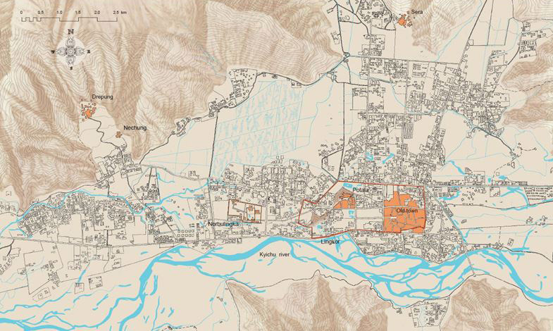
Fig. 1:
Greater Lhasa
The relationship between the Lhasa Valley, the Kyichu River, the Old Town, Potala Palace, the Summerpalace Norbulinka, the monasteries Drepung and Sera and Chakpori Hill south-west of Potala, c. 1985.
Map compiled and redrawn by Knud Larsen
2000
The Lingkor, the 7.5-km-long pilgrim path that defines the extent of Old Lhasa, is indicated with a red line.
From the book: Knud Larsen and Amund Sinding-Larsen, The Lhasa Atlas. Traditional Tibetan Architecture and Townscape (London : Serindia Publications, 2001), 15.