previous image | Wutaishan main exhibition | next image
|
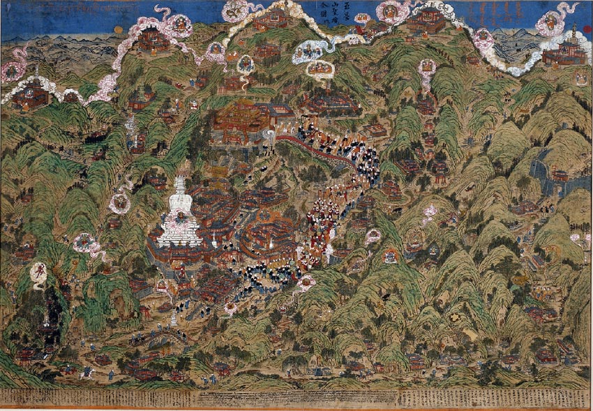
Panoramic
Map of Wutaishan
This panoramic view of the sacred mountain Wutaishan is a six- foot-wide woodblock print on cloth that has been hand colored. The map was made on Wutaishan in 1846 by a Mongolian monk at a local Mongolian monastery, Cifusi, the main lodging for Mongolian monks visiting the mountain. Pilgrims traveled this sacred mountain to see divine visions, which took the form of miraculous light and cloud formations, a ubiquitous presence on this map. all text & images © Rubin Museum of Art |
previous image | Wutaishan
main exhibition | next image