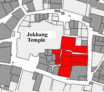

Map © Lhasa Archive Project: Based on a 1984 Survey. This map shows the Barkor area with the 7th century Jokhang temple in the centre. Shaded buildings have been replaced by new construction, only some of them in Tibetan style. Marked in red is the historic neighbourhood known as Oedepug, where the Tibet Heritage Fund carries out upgrading and conservation work with the local community. |